
Walk a St. Clair Street
A useful street directory search separates the physical site from every name attached to it. Start with a current delivery address, but do not stop there. St. Clair County DEVNET uses the situs address, the physical place of the parcel, and may show a different mailing address for the tax bill. The GIS map supplies the parcel geometry. Recorder records identify grantors and grantees in land transfers. A dated directory entry can support residence, while voter data follows a separate lawful-access process. Together, these sources answer more than a single broad name search.
- Enter a house-number range, street name, and city in the county assessor's Address Search. Open the matching parcel card and save its PIN, tax year, situs, and legal description.
- Follow that PIN into the county GIS viewer. Turn on parcels, address points, and street centerlines, then inspect the exact lot rather than relying on the pin shown by a street label.
- Use the Recorder's AVA index to search the PIN, a deed party, or a date range. Confirm a deed through its legal description and document number.
- Use election records only through the channels Illinois law permits. A voter address is not an open, bulk street roster.
- For an older household, compare dated street pages and name entries in Belleville Public Library's digitized directories.
This order keeps a St. Clair County street directory grounded in records. It also prevents a tax mailing address or institutional owner from being presented as the person who occupies a building.
Search St. Clair Streets in DEVNET
The DEVNET wEdge property portal has a distinct Address Search tab. It can search a range along one street, which is more useful for by-street work than its basic owner-or-PIN box. No ZIP field was visible in the inspected address form. Include the city because the same street name can occur in more than one St. Clair County community.
| Field | Input | How to Use It |
|---|---|---|
| House Number (Low) | Number | First number in the street range |
| House Number (High) | Number | Last number in the range |
| Street Name | Text | Street name, not the full address |
| City | Text or selection | Community name used by the parcel data |
Results can include vacant lots, public property, shops, industrial sites, mobile homes, or more than one parcel at a number. Open each card and note its tax year. The portal showed a recent data-refresh time during research, but a refresh date does not turn a tax owner into a current occupant.
The county's sample parcel card can be viewed through the DEVNET public-building record.
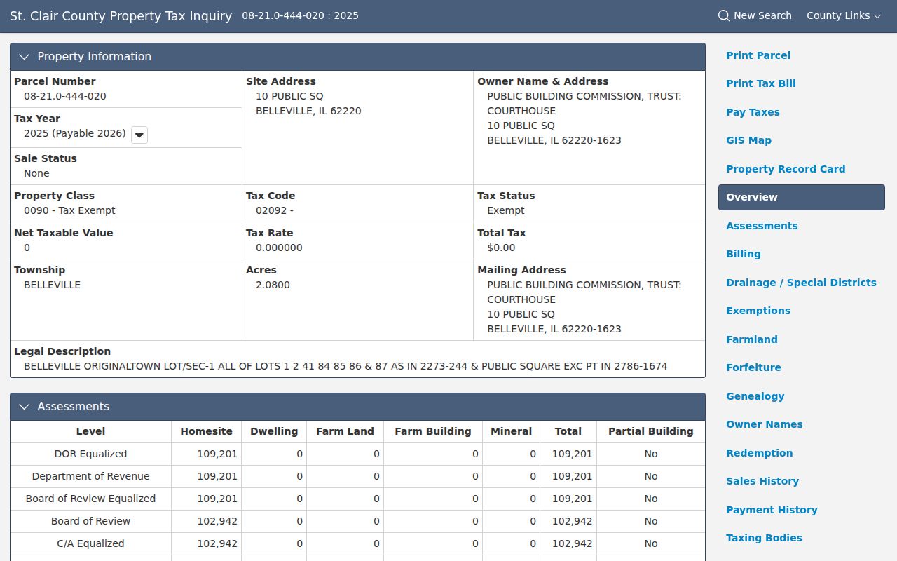
The public-building example shows a PIN, legal description, tax class, taxing bodies, and owner mailing data without exposing a private resident.
St. Clair Address Terms
A few labels keep street directory results accurate. They explain why the first name on a parcel card should not be called a resident without support from another source.
- Parcel
- A mapped piece of land with its own county property identifier.
- Situs address
- The physical address assigned to the parcel, which may differ from the tax mailing address.
- Plat
- A recorded map that describes lots, blocks, streets, or a subdivision.
- Criss-cross directory
- A directory arranged by street and house number rather than only by a person's surname.
The durable bridge is usually the PIN or legal description. Street numbers and administrative labels can change, while a recorded lot-and-block description may still identify the same land.
Map St. Clair Streets and Parcels
The St. Clair County GIS office lists parcel, address-point, street-centerline, incorporated-place, township, precinct, county-board-district, and zoning layers. Begin with a DEVNET PIN, then open the parcel link or the county viewer. Map clicks can help identify adjacent parcel polygons, but the county's text-only interface did not expose every live control name during research.
The county GIS layer page shows what is available before a map search begins.
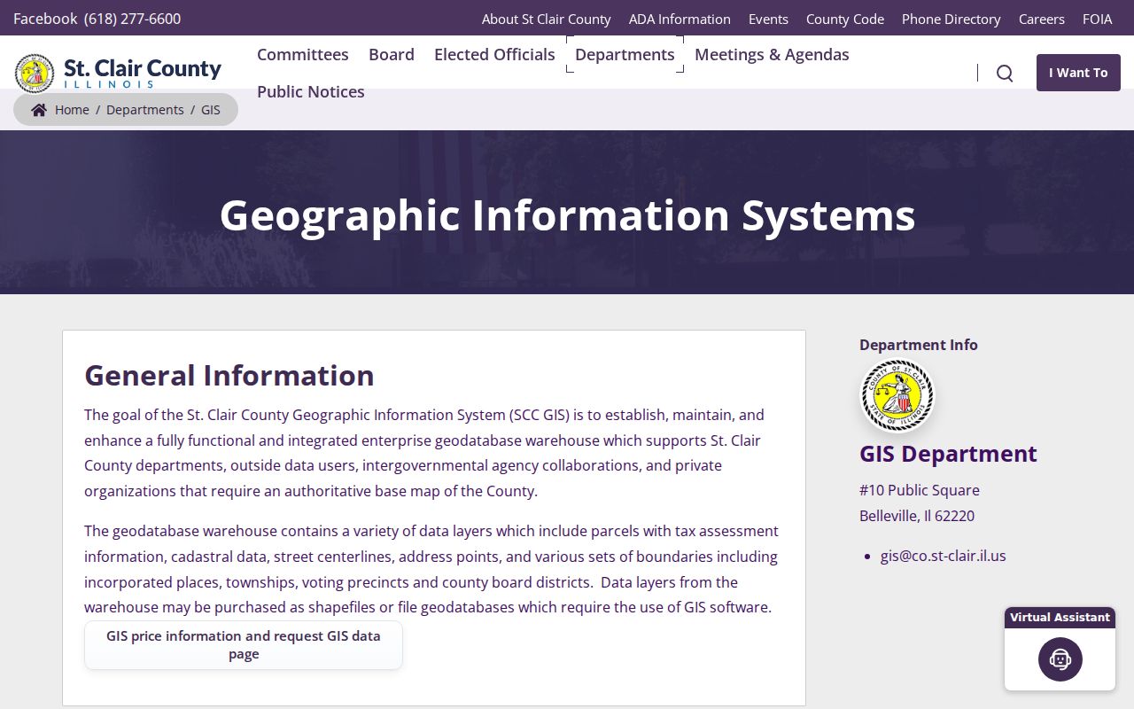
Those layers add civic and land context to an address. They do not prove who sleeps at the site, and a parcel line is not the same as a social neighborhood boundary.
The county also makes a parcels and maps guide available.
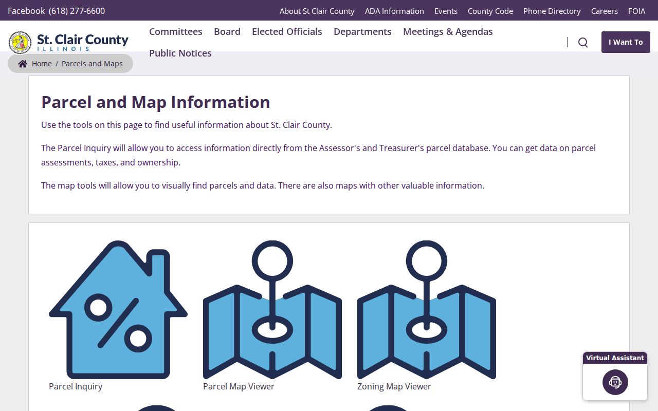
The guide helps route a street question to the correct map or parcel source instead of treating one viewer as a complete resident list.
St. Clair Records Listed by Address
No single county roll identifies everyone along a road. The strongest St. Clair County street directory combines records that each answer a narrower question.
| Address Source | County Keeper | What It Establishes | Access Route |
|---|---|---|---|
| Assessment parcel card | Assessor | Tax-record owner, situs, mailing address, class, value, sales, districts | Free DEVNET portal or office |
| Parcel and address maps | GIS | Lot shape, address points, streets, townships, precincts, zoning | Interactive viewers or GIS office |
| Deeds, plats, and liens | Recorder of Deeds | Transfer parties, dates, document references, legal description | AVA, paid image services, seven public terminals, or copy request |
| Permits and zoning files | County or municipality | Address, applicant, owner or agent, plan and inspection trail when recorded | Forms, counter, or focused records request |
| Printed directories | Belleville Public Library and local repositories | Dated resident, occupation, employer, and street listing | Digitized PDFs, library databases, or staff search |
The assessor and GIS cover the modern physical site. The Recorder confirms conveyances. Permit files can date work. Historical street pages associate a named person with an address in a set issue year. Each conclusion should retain that source label.
Link St. Clair Deeds by PIN
The free AVA index accepts a party name, recorded-date range, document number, document type, or parcel number. AVA provides index data but not document images. Tapestry EON offers a pay-as-you-go image route with grantor, grantee, date, parcel, legal-description, document-number, and book/page searches. Laredo serves subscription research. Seven courthouse terminals offer free index searching, with copies priced by the Recorder.
Save each deed's parties, recording date, document number or book/page, and legal description. A grantor conveys an interest; a grantee receives it. Search by PIN when possible because an address string may not appear in the deed. Most online documents are available from January 1986 forward, while older land research can require the Recorder, IRAD, plats, and archive indexes.
Note: A deed proves a conveyance, not that every grantee lived on the parcel.
Read St. Clair Street Directories
Belleville Public Library's digitized runs provide a different address view. The 1891-92 issue combines Belleville, East St. Louis, county towns, a business list, a street directory, and farmers or landowners. The 1925 and 1935 runs include dedicated street pages. Entries may use abbreviations such as res for residence, home, or bds for boards, along with an occupation and employer.
A printed listing is dated evidence, not a permanent claim. Compare the same address in two issues, record exact spelling, and inspect nearby house numbers. The 1884 digital run has known missing pages, so a blank search can reflect a physical gap. The full collection is described on the St. Clair County city directory page.
Resolve Old St. Clair Addresses
No inspected official source documented one countywide street-renumbering event. Old numbers therefore need case-by-case proof. Compare directory street sections, municipal minutes and ordinances, plats, and historical atlases. The St. Clair County Historical Society holds atlases from 1874, 1901, 1936, and 1956. IRAD lists deed, plat, and town-plat indexes that can bridge older land descriptions.
Administrative names changed too. St. Clair Township formed from Belleville in 1885. East St. Louis and Brooklyn or Stites were reorganized in 1888, while Canteen and Centreville split in 1910. Keep the date and historic township beside the modern city. That geography can explain why a valid address search returns nothing under today's place name.
St. Clair Permit Trails
County Building and Zoning records apply to the unincorporated area and may connect an address with an owner, applicant, lessee, or agent. No public countywide permit-name index was located. Start with the county permit page, then use the office, form, or a focused records request. A city address may instead belong with its municipal custodian.
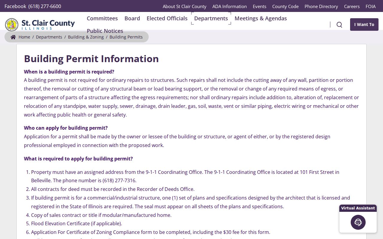
The permit page documents a current route into address files. A rule effective in 2025 added interior-plan and recorded-affidavit requirements for detached accessory buildings, which can create a dated property trail.
St. Clair Street Search Fallbacks
When the web stops, the county still offers several access channels. The Recorder accepts in-person, phone, email, and mail copy requests, though certified copies and larger orders must follow its mail and payment rules. The Assessor can help with parcel, mapping, sales, and assessment questions. GIS accepts office or email inquiries. A precise county FOIA request can seek an existing assessment roll, GIS layer, permit file, or tax-sale list not posted online.
Belleville Public Library staff will run a specific indexed name or record search for a stated fee. Supply the publication, year, municipality, spelling, and record type. The historical society and IRAD can fill old deed, plat, atlas, tax, and directory gaps. These fallbacks matter because a street directory result is often split between modern portals and older paper or film.
Municipal custody is another key branch. Belleville routes Clerk records and police records through different FOIA officers, while East St. Louis accepts written requests by mail, email, or in person through its City Clerk. Identify the city or village from GIS before filing. A county request cannot compel an independent municipality to search its own permits, minutes, licenses, or local liens. Keep the reply with the address and request date.
Limits of St. Clair Street Records
A St. Clair County street directory cannot turn a tax roll into a household roll. DEVNET may identify an estate, trust, company, public body, or owner who receives mail elsewhere. GIS shows land. Deeds show legal transfers. None guarantees an occupant. Driver address data has federal privacy protection, military discharge copies have strict access limits, and Illinois voter information follows purpose and disclosure rules rather than serving as an open by-street list.
Use public records for family history, land research, civic questions, seller verification, and other lawful personal purposes. Report a result as an owner, deed party, permit applicant, or printed resident according to its source. Do not merge those roles into an unsupported claim.
Lawful use. St. Clair County address records may be used for lawful personal research. Never use them to stalk, harass, intimidate, or harm anyone.